


Satellite Precipitation
The PERSIANN System Fine Resolution Precipitation Estimates Using PERSIANN-Cloud Classification System
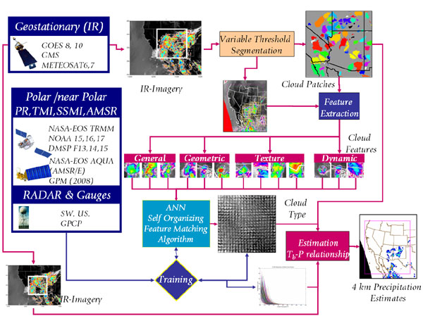
CHRS has developed a new version of PERSIANN. The new version uses computer image processing and pattern recognition techniques to develop a patch-based cloud classification and rainfall estimation system based on satellite infrared images. The system, PERSIANN-Cloud Classification System (PERSIANN-CCS), enables the categorization of cloud-patch features based on cloud height, areal extent, and variability of texture estimated from satellite imagery.
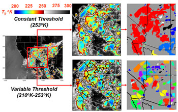
At the heart of PERSIANN-CCS is the variable threshold cloud segmentation algorithm. In contrast with the traditional constant threshold approach, the varible threshold approach enables the identification and separation of individual patches of clouds. The individual patches can then be classified based on texture, geometric properties, dynamic evolution, and cloud top height. These classifications help in assigning rainfall values to pixels within each cloud based on a specific curve describing the relationship between rain-rate and brightness temperature.
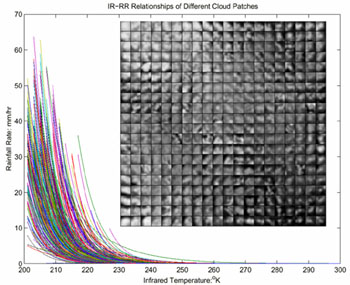
Tb-Rain rate relationship varies according to cloud classification. Each curve represents the relationship for one of the cloud classes.
Precipitation intensity and distribution of classified cloud patch is initially trained using ground radar and TRMM observations. The PERSIANN-CCS enables recursive (in space and time) data assimilation and system training, allowing for flexibility in the adjustment of the cloud-rain distribution curves as new ground or space-based radar measurements become available.
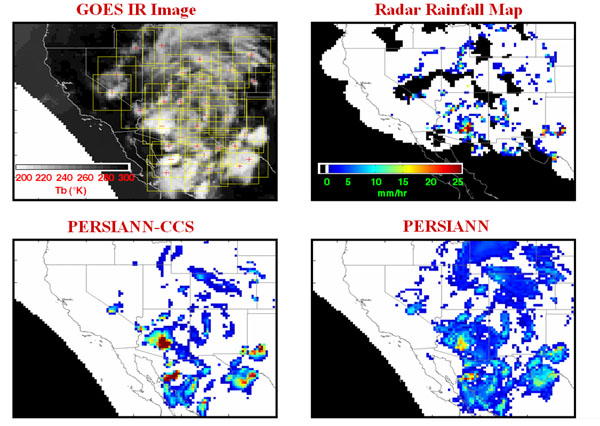
Comparison between NEXRAD, PERSIANN-CCS and PERSIANN at 4 km instantaneous rain-rate. Notice that PERSIANN-CCS captures the spatial distribution of precipitation better than the traditional PERSIANN. Notice also the presence of substantial missing areas of data in the NEXRAD image due to topographic effects.
Future Plans:
- Data quality
- Real-Time Operational over continental U.S.