


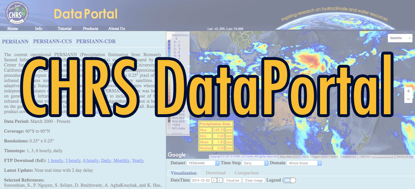

Satellite Precipitation
Premises
The traditional approach for estimating precipitation from satellite information relies on statistical relationships between IR measurements of cloud top brightness temperature and mean rainfall rate. However, due to many factors including cloud type and local atmospheric conditions, such relationships are associated with large uncertainties. If we are to produce precipitation estimates at finer temporal and spatial resolutions, it is necessary to develop an improved method and devleop new models relating satellite information to precipitation. Such model must:
- extract information from multiple input features (variables) that are related to the precipitation process,
- perform sophisticated classification and mapping in a multidimensional input-output space,
- rapidly process the large amounts of data that make up satellite images while in an operational mode, and
- be able to automatically update itself whenever ground-based or other sources of data are available.
Such model could be constructed through the use of methods that synthesize computer-based artificial intelligence techniques with the theory of precipitation process and practical experience. With proper formulation, and usage of powerful organization algorithms, artificial neural networks (ANN) have the potential to resolve all of the above requirements.
The goal of CHRS's satellite precipitation estimation research is to ultimately reach accuracy and spatio-temporal resolutions suitable for hydrological research and applications.