


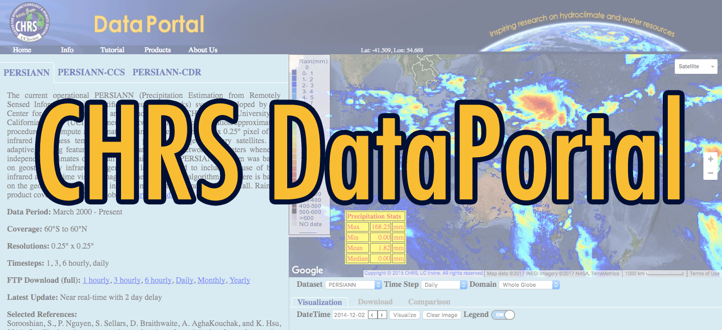


Hydrologic Prediction
Premises
Our focus region is the semi-arid southwestern U.S., where the hydro-meteorology of the region consists of two distinct seasons. Winter is characterized by middle latitude cyclones and frontal systems originating from the Pacific Ocean and moving cross the continental United States. Winter precipitation, especially snowfall, derives from frontal storms and is concentrated over the mountains, providing the major water resource for the region. Spring snowmelt can occur very rapidly, in only a few days, with very rapid changes to the dynamics of land surface processes, bringing about sudden and severe flooding along the mountain fronts. Summer weather is primarily controlled by the North American Monsoon System (NAMS). Before and after the monsoon, the climate is very dry. However, the monsoon period (July to September) is characterized by severe thunderstorms and lightning storms. Convection preferentially develops over the high terrain. Movement of the convective cells away from the high terrain results in short-lived, air mass type thunderstorms. If the upper-level wind profile is favorable, there can be organization of the convection into tropical squall lines or into mesoscale convective systems that can persist for several hours. The resulting precipitation is characterized by high intensities and significant heterogeneity in space and time, and is strongly influenced by topography. The monsoon precipitation provides much-needed water for this semi-arid region while also being the primary cause of severe weather damage from wind, hail, lightning, and flash floods.

California Nevada RFC
The CNRFC has hydrologic forecast responsibility for California, most of Nevada, and a portion of southern Oregon. CNRFC office is located in Sacramento, CA.
The variability of weather (most importantly, precipitation) is strongly linked to the hydro-meteorological interactions between the southwest and surrounding regions. The eastern Pacific Ocean modulates the synoptic atmospheric circulation and provides most of the atmospheric moisture that falls as precipitation. Snow over the Rocky Mountains plays an important role in the regional water and energy balances, while providing the dominant water resource for the region. Rainfall over the Great Plains on the Eastern side of the mountains is negatively correlated with the strength of the monsoon rainfall (a seesaw phenomena “rapid switch of oscillation”). The role of the Mexican plateau, located between the tropical oceans and southwestern U.S., is not well understood. A better understanding of these connections is crucial to the improvement of regional hydrometeorologic predictions.
Remote sensing data and products from NASA’s Earth Observing System satellites such as TRMM, TERRA, and AQUA provide unprecedented opportunity to improve our understanding of the above-described complexities. From these instruments, high resolution observations of sea surface temperature, vegetation conditions, snow cover conditions, atmospheric moisture profile, surface temperature, cloud properties, and precipitation have now become available for the entire globe. In the context of improving hydrologic prediction, the challenge is to seamlessly integrate NASA EOS information into various predictive tools to improve operational weather prediction, flood and severe weather warning, and management of water supply, forestry/natural resources, urban demand, and irrigation. CHRS focuses on addressing these challenges through studies to improve predictive tools, and to develop mechanisms to integrate modern information into these tools.